Construction Process Solutions
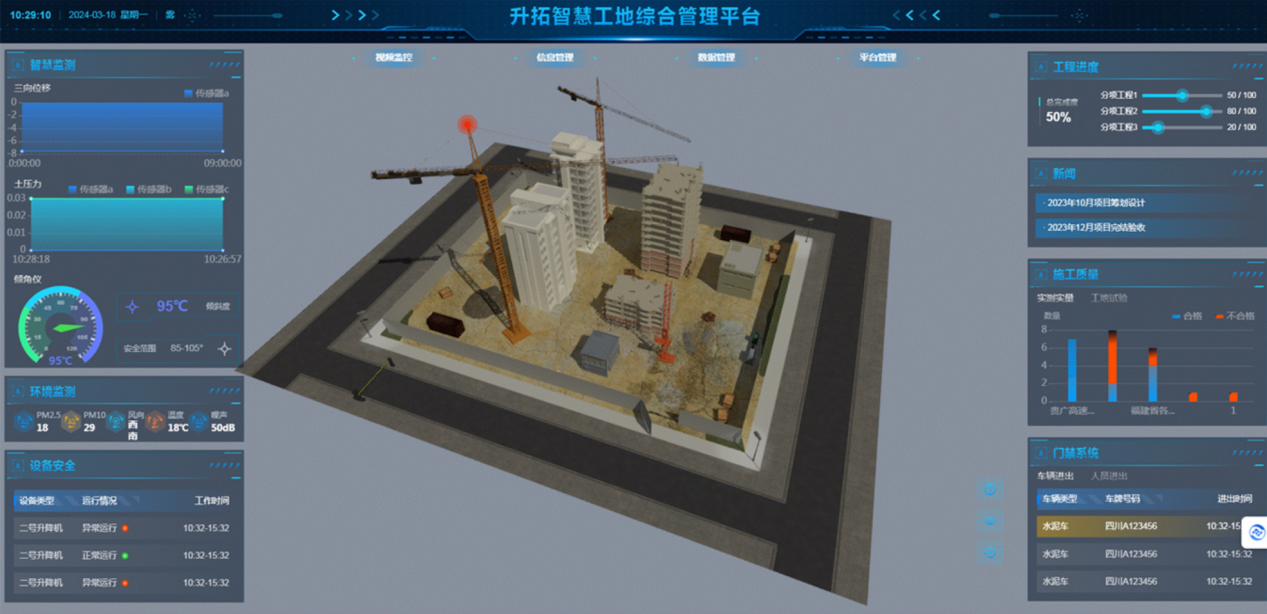
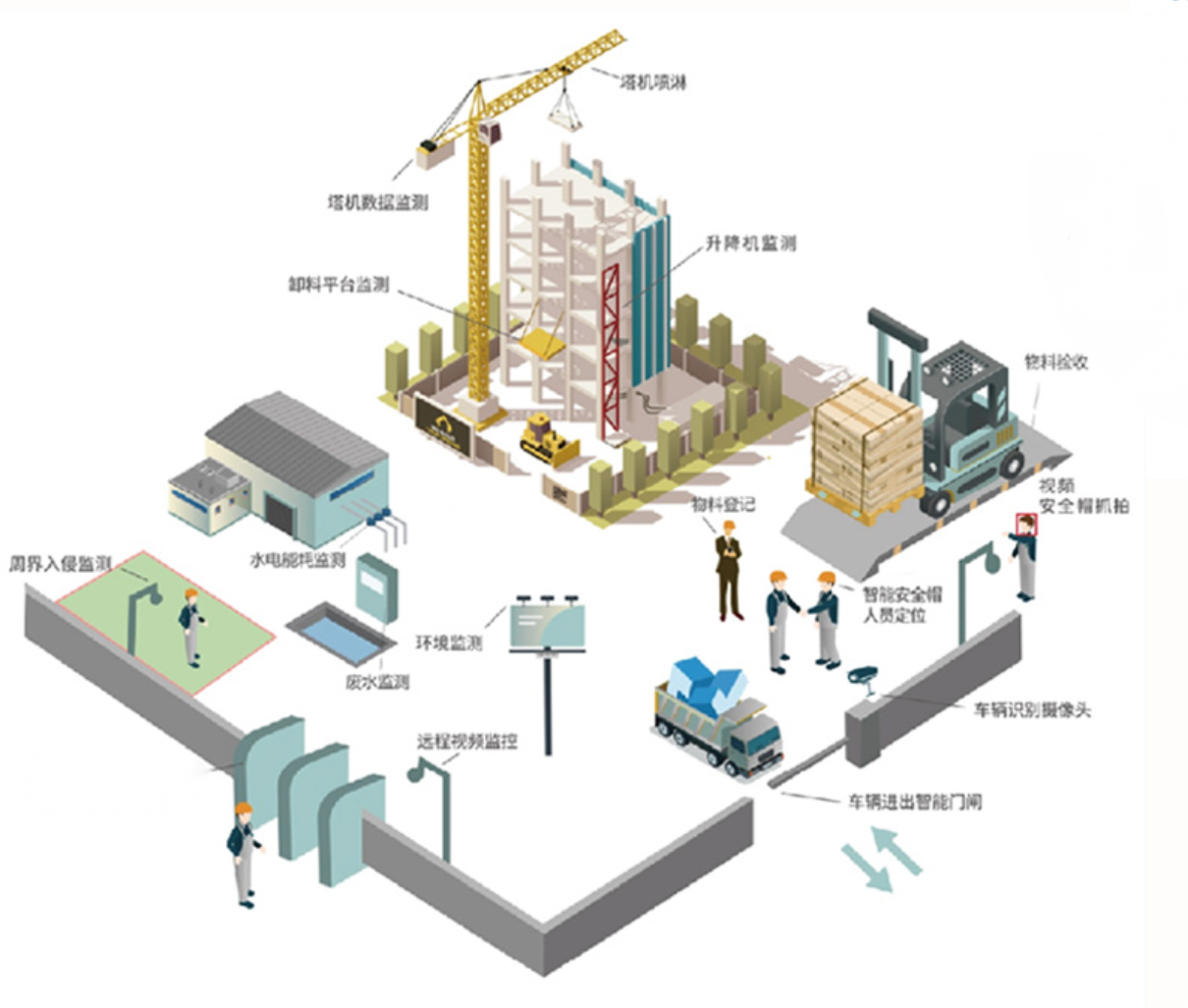
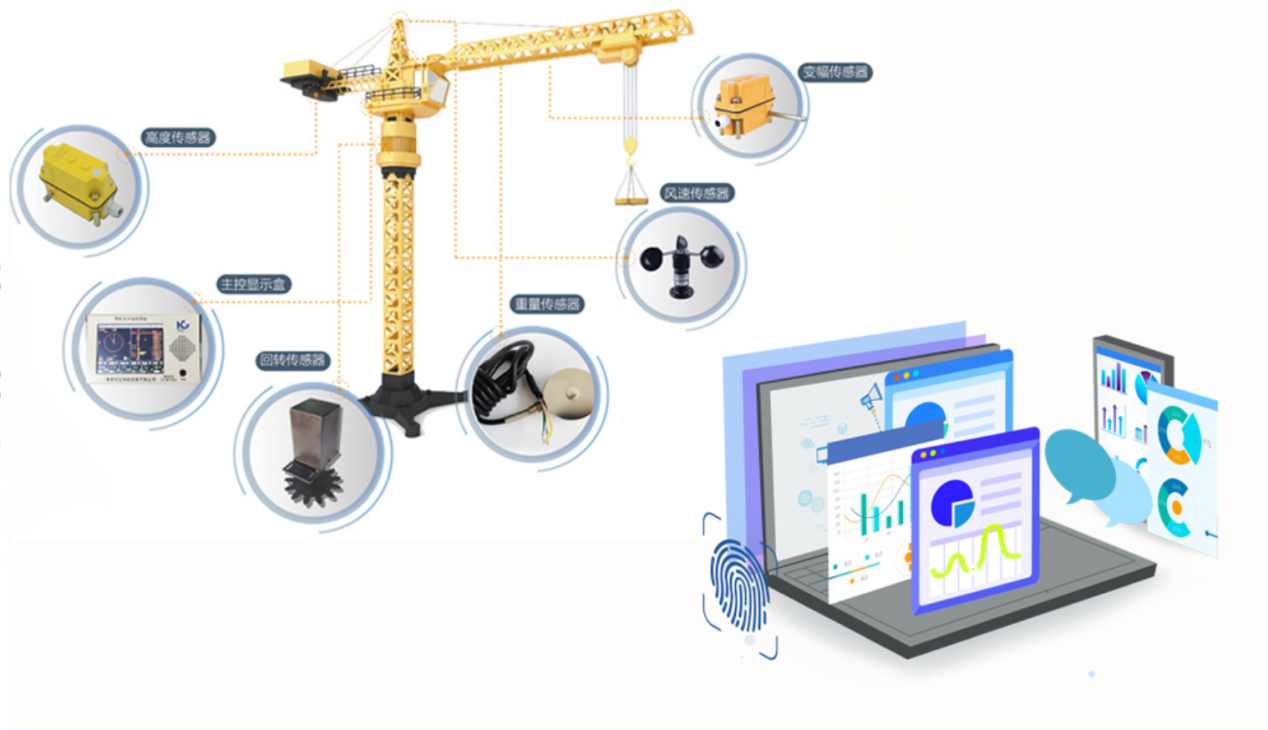
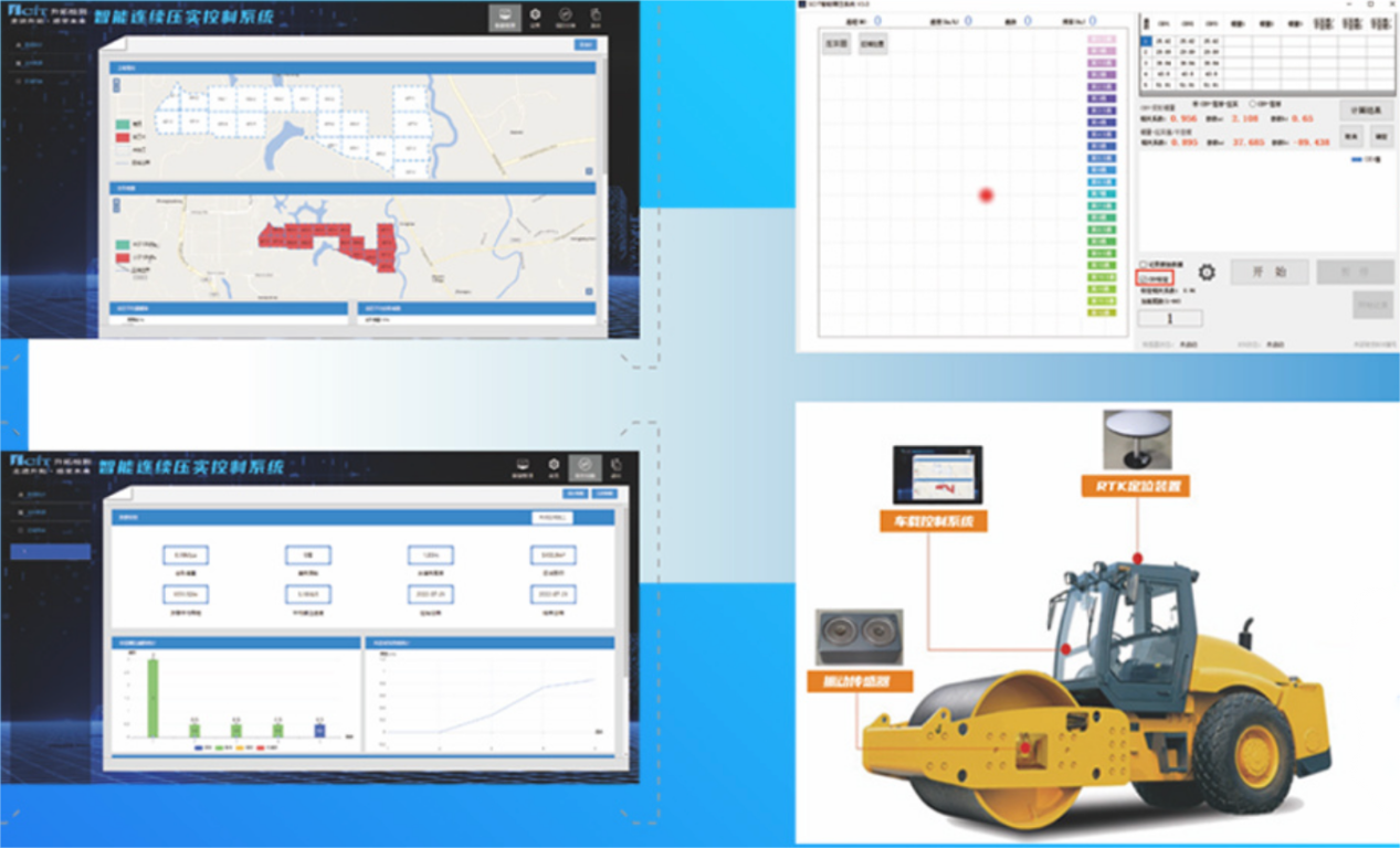
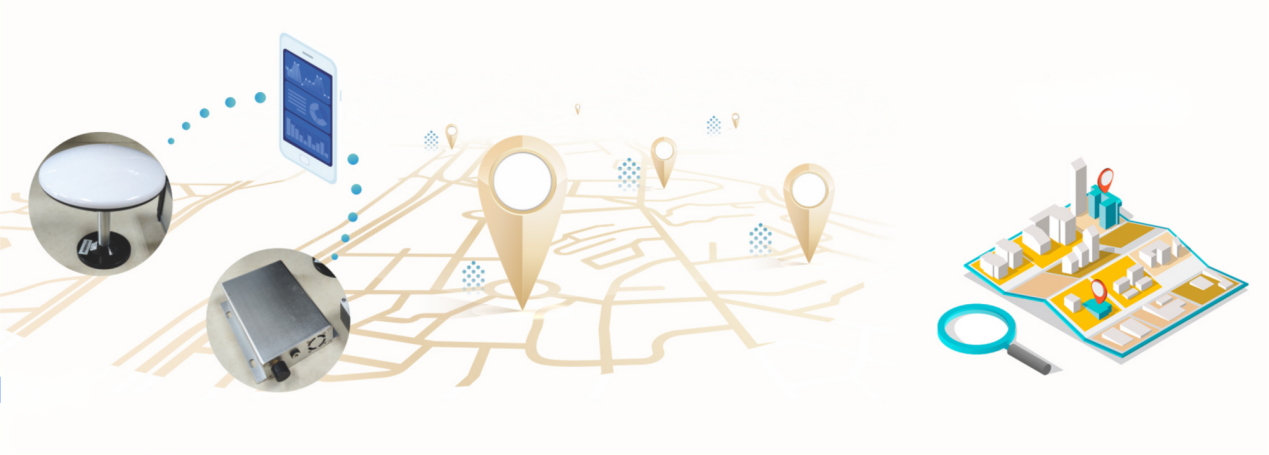
This solution integrates and utilizes various technological means such as the Internet of Things, the Internet, cloud computing, big data, artificial intelligence, building information modeling, computer vision, edge computing, off-grid intelligence, laser radar, radio frequency identification, etc. It focuses on collecting and analyzing comprehensive data information of project construction processes regarding personnel, machinery equipment, material environment, safety, quality, production, etc., to achieve intelligent management of the construction process through ubiquitous connectivity, comprehensive perception, safe operation, intelligent production, efficient collaboration, intelligent decision-making, and scientific management.
Digital
BIM Visualization System
Intelligent Continuous Compaction Control System
Automated Monitoring System
Functional modules
Platform Display
Digital Delivery
- By integrating the "topography and features" of the physical world with the "construction projects to be built" and "operation activity risks" in the digital space, a high-precision digital map of quality, safety and progress risks is formed. This provides a foundation for the automatic operation of intelligent equipment during the construction process.
Equipment Management
Establishing an intelligent monitoring and prevention system can effectively make up for the shortcomings of traditional methods and technologies in equipment management.
Intelligent Continuous Compaction Control (ICCC)
Precise Positioning, Construction Guidance, Real-time Management
- Pavement roller trajectory monitoring
- Continuous generation of compaction degree charts
- Automatic calculation of the number of rolling
- Real-time online supervision of information such as the filling layer height and the current filling elevation
Digital Identity
Identity Information
- By using NFC, RFID chips or QR codes to record and bind the relevant information of personnel, equipment and components, during the inspection process, by scanning the chips or QR codes with mobile phones or scanning guns, the information of the inspectors, inspection equipment and inspected components can be quickly entered. (Description)
Location Information (GNSS)
- Using mobile phone GPS positioning enables convenient and real-time upload of personnel's location information. For engineering structures, GNSS and RTK equipment can be used to obtain their real-time location information.
Contact Us
7th Floor, Building 4, No.355 Wuxing Fifth Road, Wuhou District, Chengdu City, Sichuan Province 610041, China
Mail Liuq@scentralit.com
+86 (028) 6861 1516
9 A.M to 5 P.M on workday